Mitterkirchen – Grein Stage


- culturally interesting
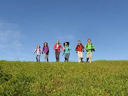
- Multi-day tour
Interactive elevation profile
Create PDF
Tour-Details
Paths covering:
The Donausteig - simply fabulous! Summit assault onto the Gobelwarte - one of the seven Donausteig-peaks. We are moving from the plains of fertile Machland over the promising Gobelwarte into the narrow Donaukerbtal (valley) of the Strudengaus. We discover the "Machlanddamm (dam)" the project of the century, a collegiate church without an abbey, a castle in which history lives, the inspiring Klamschlucht (gorge)...
Recommended season:
- March
- April
- May
- June
- July
- August
- September
- October
- Multi-stage route
- Scenic
- Refreshment stops available
- Cultural/historical value
- Geological highlights
- Insider tip
- Summit route
Seal of approval:
- Quality route according to "Österreichisches Wandergütesiegel"
This Donausteig-stage starts in Mitterkirchen. The rural market is located near the Danube River in the heart of the Danube Plains of the Machland. The mighty flood defences of the Machlanddamm illustrates that life with the river Danube means always living with the risk of floods - an impressive start to the stage. From here we trek on rural back roads through the vast fields of the fertile plains of the Machland. The Celtic village of Mitterkirchen gives us an insight into the world of the Celts - unique on the Donausteig! Further towards the edge of the Machland plain we reach the edge in Baumgartenberg. Here, the "Stiftskirche ohne Stift" (church without an abbey) reveals its secrets to us and also tells about the settling of the mühlviertel (region).
In Baumgartenberg begins an attractive trek through the Mühlviertler hills to the Burg Clam (castle). Initially the looks reach far beyond the Machland, later small fields and quaint forests dominate the hilly landscape. On rural and old forest roads, we reach the Burg Clam (castel)- a real gem! Fully furnished and since 1454 inhabited by the family Clam, it allows an unusually personal approach to history. From here, we walk on to the idyllic market Klam passing down through the wild and romantic Klamschlucht (gorge). Mystic rock formations and the splashing of water provide us with inspiration - as once famous poets and painters were inspired. In Obersaxen, we reach the edge of the Machland plains again.
The farmers market is one of the oldest parishes in Upper Austria and amazes with its mighty Church in the village centre. Here begins our summit assault. On old footpaths and tranquil forest paths we gain altitude quickly. The climb through the rural landscape inspires with its beautiful far-reaching sites and beautiful landscape impressions. Arrived on the Gobelwarte (mountain) we are on one of the seven Danube climbing peaks. We did it - congratulations! Here on the one hand are the wide plains of the Machland and on the other the narrow Kerbtal (valley) with the historic city of Grein at its foot. We are therefore on the separation between the Machland and the Strudengau. On the descent after a few minutes we reach the Donausteig-resting point "Gobelwarte" with its unique view – the distance between the Machland and the alps seem almost limitless! Now we finally bid farewell to the Machland. A forest descent brings us down on forest paths and hiking trails to the historic town Grein, the gateway to the Strudengau. Conclusion: A Summit assault of the especially kind - simply fabulous!
Discover the following features with the Donausteig-diary
-The Donausteig-starting point "Mitterkirchen"
-The Project of the century "Machlanddamm (dam)"
-Wallsee and the Danube-limbs
-Donausteig-resting point "Keltendorf"
-Celtic village of Mitterkirchen-the cattle barons of the Hallstatt times
-Donausteig-starting point "Baumgartenberg"
Baumgartenberg-Abbey Church without an abbey?
-Arbing-a piece of Bavaria
- ...
Download: Donausteig-diary "Stage 4_G05 Mitterkirchen Grein" - yet to follow!
Directions:From the Donausteig-starting point on the outskirts in Mitterkirchen, we follow the paved road past the flood dam East up to the Naarnbrücke (bridge). Before the bridge, we turn left upstream. On the Naarnbrücke (bridge) in Labing, we cross the Naarn and follow the paved road to the East. After approx. 100 metres we turn left. We leave the route during the preliminary stage of the Donausteig at the intersection and turn right towards Lehen. The Museum "Celtic village of Mitterkirchen" is located at the end of the road on the right hand side. At the T-intersection, we follow the left road over Kühofen up to the former Abbey Baumgartenberg. Here between the school sports field turn left and cross the railway tracks subsequently. On the main road continue left. After 150 m turn right down a footpath leading uphill - first along the route, then turn left across the meadow. The descent into the forest starts on the right, but then leads on a sharp hook again left at the edge of the forest. From there, the way to the right takes us to the Landgasthof Rechberger (inn). Here cross to the right the main road at the car dealership. Following the asphalted road Steindl we passed a high ridge the Donausteig-resting point "Weißes Kreuz". At the cross by the intersection, we then turn right and continue through a small basin to reach a 180 ° right curve (shortly after the second river). In the radius of the turn, we turn left from the tarmac road and follow the trail up to the Donausteig-resting point "Mühlberg" in Sperken. Further, the path goes downhill onto the asphalt road towards Klam. After about 250 metres we turn right onto a path (bike path to the Burg Clam) and reach the Castle Klam after a few minutes. From the Castle car park we follow the asphalt road again downhill in the direction of Klam, passed the Donausteig-starting point "Klam" to the bridge of the Klambaches (river) at the southern end of Klam. Prior to the bridge, turn right. Now we walk through the Klamschlucht (Gorge) down to Au (A part of Saxen). Left, the settlement road brings us up to the T‑Kreuzung at the cultural center of Sturmmühle. There on the local road turn left towards Obersaxen. After a good 800 m we turn at the large crossing to the right follow the road almost straight up to the music school. On the north side of the school, a walk leads directly into the Centre of Saxen. We circle the the parish church to the south and turn left at the junction to the Inn Auer. There a path to the right leads between houses uphill. We quickly leave the area. At the next farm hamlet (2 houses) we remember uphill towards the North. Shortly before the eye-catching Hubertus Chapel, the trail leads straight through the Woods. Then, we follow the road straight uphill - to a second farm. Turn left downhill. Passed a meadow and a forest, we reach a forest path above a large farm. We follow it right through the woods slightly uphill, until we reach the Votivkapelle (chapel) on the asphalt road. Here turn right and after 50 m turn left - on this road we reach the Gobelwarte, the highest point of the stage. From there we follow the asphalt road - downhill - until its end at the farmstead of Plank. Turn Right, and a walk through the woods brings us rapidly downhill. At a House, we reach a forest road which we follow to the left. After about 500 m, we leave it again and hike along a trail winding up to the outskirts of Grein. Over the railway tracks, we reach the main road, which we follow up to the Donausteig-starting point "Grein" at the Donaulände (park).
To facilitate the orientation, the Donausteig was provided with its own system of orientation - you will find the description here .
Tip:- A tour in museum "Keltendorf Mitterkirch" provides in detail sites into the world of the celts!
- A castle tour at Burg Clam (castle) provides not only a new experience of teh Donausteig, but also shows a personal trait of the still living there family Clam!
Journeys of discovery with an enjoyable stopover! This tour leads directly past the following culinary partner:
Radlerbauernhof Moser in Mitterkirchen
https://www.donauregion.at/oesterreich-gastronomie/detail/104263/radlerbauernhof-moser.html
Equipment:
On top of basic hiking gear, one should only take notice of the fact that there are no restaurants/inns between Saxen and Grein.Additional information:
WGD Tourismus GmbH
Lindengasse 9
4040 Linz, Austria
Tel. +43(0)732/7277-800
Fax. +43(0)732/7277-804
info@donausteig.com
Market municipal office Mitterkirchen
4343 Mitterkirchen 50
Tel.: +43(0)7269/8255-0 Fax: DW25
gemeinde@mitterkirchen.ooe.gv.at
www.mitterkirchen.ooe.gv.at
Tourism center Grein/Donau
Stadtplatz 7
4360 Grein
Tel./Fax: +43(0)7268/7055
info.grein@oberoesterreich.at
www.oberoesterreich.at/grein
further information:
- Multi-day tour
- Board possible
")
")


")


Direction information: Departure
Direction information: Destination
")
")
")
")
")
")
")
")
")
")
")


")
")

")
")

")
")
")
")
Getting there
From the parish church in Mitterkirchen follow the main road to the east. After approx. 230 m at the junction next to the Kraglhof (in a left curve) turn right onto the sport area. At the next junction the Donausteig-starting point lies on the left hand side (Navigation: A-4343 Mitterkirchen im Machland, Sportzentrum).
Public Transit
Mitterkirchen can be reach by bus. A transfer back from Grein to Mitterkirchen is possible as well by bus. Bus timetables online at http://www.ooevv.at .
Parking
Directly next to the Donausteig-starting point "Mitterkirchen" there are the parking possibilites of the sport center. Two further large parking lots, free of charge as well, are at the city center (one 100 m north of the church and the other 100 m south of the church at the primary school).
- Spring
- Summer
- Autumn
Please get in touch for more information.
Lindengasse 9
4040 Linz
Phone +43 732 7277 - 800
Fax machine +43 732 7277 - 804
E-Mail gemeinde@mitterkirchen.ooe.gv.at
Web www.donauregion.at
Web www.oberoesterreich.at/oesterreich-…
https://www.oberoesterreich.at/oesterreich-stadt-ort/detail/430001068/grein-an-der-donau.html
Vis-à-vis users
1. The tours presented for hiking, walking, biking and road biking, mountain biking, motorbiking, horseback riding, climbing, cross-country skiing, and going on skiing and snowshoe tours etc. are to be considered non-paid tour recommendations and only serve as non-binding information. We have no intention of concluding a contract with the users of this website. The utilisation of the data does not lead to the establishment of a contract with us.
The data may only be used for private use; any commercial use is prohibited. In particular, it is not permissible to offer the data on commercially run websites, file-sharing platforms etc. or to use it to develop commercial products. Downloading data does not imply that users are granted rights to the data concerned.
The tour recommendations posted were created with utmost care; nevertheless, we assume no liability for the correctness and completeness of the information.
We point out that neither the tour recommendations included on this website nor the associated data and information were posted by us, but rather by third parties (Art. 16 Austrian E-Commerce Act). We have no influence on whether the details provided (e.g. distance, level of difficulty, change in altitude, description etc.) are authentic, correct and complete. We do not review these third-party contents. For this reason, we assume no liability for the authenticity, correctness and completeness of the information.
Construction-related measures or other influences (e.g. landslides and similar occurrences) can lead to temporary or permanent changes in a route (e.g. loss of a bridge and similar occurrences). Such occurrences can lead to part of the route or the entire route becoming impassable.
The use of the data as well as undertaking (riding, walking, taking etc.) the recommended tours or using the network of paths occurs at users’ own risk and on their authority. In particular, users themselves are responsible for the choice of route, outdoor orientation, adherence to traffic rules, supplies and equipment for tours listed in Point 1 (e.g. bicycle etc.), wearing a helmet, estimating their own fitness, recognising dangers and maintaining an appropriate velocity. We exclude ourselves from any liability whatsoever for damages, in particular accidents, that occur whilst taking part in the recommended tours.
2.Some of the tours lead over roads with normal traffic conditions. Please observe that there is an increased risk which can be avoided by means of appropriate attention and proper estimation and implementation of one’s own abilities. For this reason, please travel a route that is unfamiliar to you slowly and with special care. Pay constant attention to potential dangers and always observe traffic. Do not leave the routes featured in descriptions.
The potential use of private roads, in particular forestry roads and agricultural transport roads, can be subject to legal restrictions, which must be observed and adhered to.
The normal traffic rules apply. Each user (e.g. biker, motorbiker) is responsible for adhering to these rules and maintaining his/her bike/vehicle and its equipment (lights, brakes etc.) in good working order. Each user is also responsible for ensuring that he/she rides at a velocity that is appropriate for the conditions and his/her skill level and for maintaining sufficient distance to the rider in front. We explicitly recommend adjusting velocity to correspond to the respective field of vision, wearing a helmet, using reflective clothing (or similar) and employing bicycle lights in line with regulations.
3.Each tour requires good physical fitness as well as detailed planning. We explicitly recommend only taking the tours in the case of optimal healthiness.
We recommend that you conclude an accident and liability insurance policy. Use an onboard computer that displays the respective kilometres travelled per day and is calibrated for the front wheel.
4.Special for mountain bikers – Fair-play rules:
Mountain biking is one of the most wonderful outdoor leisure-time activities. Whilst biking or on a mountain biking tour, mountains and lakes, meadows and cabins are re-discovered in new ways. A couple of rules for fair play in the forest help to avoid conflicts whilst mountain biking.
a.Pedestrians have the right of way: We are accommodating and friendly to pedestrians and hikers. Upon encountering these fellow travellers, we alert them by using the bicycle bell and slowly overtake them. We avoid paths with heavy pedestrian traffic altogether. Take nature into account: We do not leave refuse behind.
b.The braking distance should be half of the total distance visible: We ride at a controlled pace, are ready to brake and maintain a braking distance half as long as the total distance visible, especially in curves, because we always have to count on obstacles on the path. Damage to the path, stones, branches, wood piles, grazing livestock, cattle grids, barriers, tractor-type forestry machines and authorised vehicles pose dangers that we need to be ready for.
c.Don’t drink and drive!: Do not drink alcohol when mountain biking. Take care at stop-off points (dealing with bike racks, dirty shoes or clothing).
It is obligatory to provide first aid!
d.Marked routes, closed paths and blockades: Keep to the marked routes, observe the blockades and accept that these roads are primarily for agricultural and forestry use!
Blockades can often not be avoided and are in your own interest. Biking beyond the intended path and outside of opening times is punishable and turns us into illegal bikers.
e.We are guests in the forest and behave accordingly, including vis-à-vis forestry and hunting staff. Whilst mountain biking, mobile telephones and music players are forbidden! Biking requires your full attention.
f.Avoid unnecessary noise. Out of consideration to the animals living in the wild, we only bike during full daylight. As a principle, we always wear our helmet (even when riding uphill)! Don’t forget emergency supplies: We always have a repair set and bandages along.
g.Don’t overestimate your skills: We should not overdo it when it comes to biking technique and physical fitness. Take the level of difficulty posed by the route into consideration and make a precise estimate of your experience and skills as a biker (braking, bell, lights)!
h.Close gates: We approach grazing livestock at a walking pace and close every gate behind us. We should avoid causing escape and panic reactions in the animals. Nothing stands in the way of the fun and athletic challenge in the mountains and forests!
i.Traffic rules: The general traffic rules (StVO) apply for all the mountain biking routes and we adhere to them. Our bike therefore needs to be in perfect technical condition and equipped in line with the traffic rules, including brakes, a bell and lights. We inspect and service our mountain bikes regularly anyway.
5.We assume no liability for the contents of external websites; in particular, we assume no liability for their statements and contents. Moreover, we have no influence on the design or contents of the websites to which hyperlinks on guide.oberoesterreich.at lead or from which hyperlinks lead to guide.oberoesterreich.at. There is no on-going review of websites to which hyperlinks on guide.oberoesterreich.at lead or from which hyperlinks lead to guide.oberoesterreich.at. We do not appropriate the contents of websites to which hyperlinks on guide.oberoesterreich.at lead or from which hyperlinks lead to guide.oberoesterreich.at.
Vis-à-vis bloggers
PLEASE OBSERVE:
1. Each of your tour recommendations for hiking, walking, biking and road biking, mountain biking, motorbiking, horseback riding, climbing, cross-country skiing, and going on skiing and snowshoe tours etc., along with other details and information, is free of charge. In particular regarding the correctness of the information, we assume no liability, nor do we assume any liability whatsoever for the consequences of the use of your tour recommendation by a third party (in particular by a user of this website). We do not review the tour recommendations you post, including other details and information, at any time.
We have no intention of concluding a contract with persons who post tour recommendations and/or other details and information on this website. Posting data (information) does not imply that a contract has been concluded.
By recommending a tour, we assume special responsibility vis-à-vis other athletes. Please take this responsibility seriously and describe your tour recommendation with utmost care and to the best of your knowledge and belief.
2.Your tour recommendations must therefore clearly and unambiguously include at least the following criteria and provide a sufficiently detailed description:
• Starting point
• Detailed route description
• Distance/Overall distance
• Level of difficulty
• Dangerous spots
• Average duration of trip
• Change in altitude
• Finishing point.
If possible, please provide the change in altitude.
3.When you post a tour recommendation, you give us the order to save your tour recommendation and/or the details you provide on our website and to make it/them accessible to third parties, in particular to users of this website, in the long term. We reserve the right to block or delete tour recommendations and/or other details and/or information that you post, either partially or entirely, at any time without providing a justification. Should this occur, it grants you no rights whatsoever.
Thank you for your efforts!
4. We are not responsible for the contents of external websites; in particular, we do not assume any liability for their statements or contents. Furthermore, we do not influence the design or contents of websites that can be accessed from guide.oberoesterreich.at via hyperlinks or that use hyperlinks to refer to guide.oberoesterreich.at. The websites that can be accessed from guide.oberoesterreich.at via hyperlinks or that use hyperlinks to refer to guide.oberoesterreich.at are not regularly monitored. Furthermore, we do not assume any claims to the websites that can be accessed from guide.oberoesterreich.at via hyperlinks or that use hyperlinks to refer to guide.oberoesterreich.at.
Interactive elevation profile
Create PDF
Tour-Details
Paths covering: