Donausteig Stage 3_S07 Enns - Mauthausen: „Salt, iron, and granit“


4040 Linz

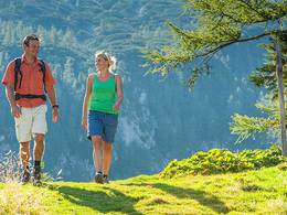
The Donausteig-simply fabulous! On this very short stage, we hike from Enns at the edge of the hilly Traun-Enns-Riedellandes (region) through the farming landscape of the Danube region to the Danube and Mauthausen. We discover the oldest city in Austria, medieval trade, the cradle of Christianity in Upper Austria, the Roman Legion camp in Lauriacum, fascinating granite art...
Recommended season:
- May
- June
- July
- August
- Multi-stage route
- Refreshment stops available
- Family friendly
- Cultural/historical value
Seal of approval:
- Quality route according to "Österreichisches Wandergütesiegel"
Enns, the oldest city of Austria, is the starting point of this Donausteig-stage. The historic city lies on a soft and elevated ridge, a Riedel (hill) of the Traun-Enns-Riedellandes (region). We start directly at the magnificent main square next to the 60 m high city tower. Rich facades and architectural details are evidence of prosperity and wealth springing from the salt trade. The picturesque old town is the first highlight of this stage. The trail leads down to the edge of the old town and from there in the newer parts of the town in the Danube plain. Here the next two highlights await us: the Basilica of St. Laurenz, considered the cradle of Christianity in Upper Austria, and the ruins of the Roman Lauriacums, a strategic military camp and important administrative town at the same time! Further on, the trail quiets down. After the train station, we leave the city and immerse ourselves in the rural landscape of the Danube plain. Fertile fields and farming settlements alternate at short intervals. Some grotesque, remote industries seemingly sprout straight from the fertile fields in the foreground - exciting especially for photographers! Shortly after Enghagen, the road bends towards the Danube. Initially the road continues along the edge of the Au (river), later through the lowland forest up to the lonely Donausteig-resting point „Radfähre“ directly on the banks of the Danube. The splendid view from here to the opposite Mauthausen invites to enjoy and ponder! The Radfähre (ferry) leads us, as in ancient times, across the mighty Danube River. The final highlight is the market of Mauthausen. In addition to its history, the city enchants with its granite art - simply fabulous!
Discover the following features with the Donausteig-diary:
-Enns-the oldest town of in Austria
-City Tower Enns-a confident landmark
-The Enns-iron River
-Basilica of St. Laurenz-the cradle of Christianity
-Lauriacum-border area of the Roman Empire
-Chapels-narrative monuments
- Donausteig-Resting point „Radfähre“
-Mauthausen-the granite Art Center
- ...
Download: Donausteig-diary "Stage 3_S07 Enns Mauthausen" - yet to follow!
Note: For this stage, you will need the use the Radfähre (ferry) Enns-Mauthausen (See section "Public transport" for timetables)!
Directions:From the City Tower on the main square in Enns, the Donausteig follows the Linzerstrasse straight towards the West. At the Y-shaped crossroads (left next to it is a small park with a Carl Adam Kaltenbrunner monument) turn right into the Alter Schmidberg-strasse (road). After approx. 40 m downhill you reach a seemingly T-crossing. Attention: leave the Road and go straight down the stairs! The footpath turns after a few minutes into the Doktor-Marckhgott-Platz-Straße (street). Follow this street straight ahead. Cross the heavily trafficked Stadlgasse (road) and at the next crossroads turn left. Follow this settlement road to the wayside shrine of St. Severin. Turn left over the bridge into the Maria Anger-Straße (street). From the Basilica of St. Laurenz the Donausteig continues along the Lauriacumstraße (street) leading to the train tracks. At the tracks turn right and pass beneath the tracks at the station. After the railway underpass follow the Fabrikstraße 100 m East and turn into the Mühlenstraße (street). Now, the landscape is rural! At the next T‑Kreuzung (Chapel), turn left onto Lorcher Straße (street). Keep to the right at the next T junction and follow the major road up to the large Road underpass. After the underpass continue half left the rural road to the Centre of the village Enghagen. There turn right to the Inn Binder and follow the road to until a road branches off to the Cyder Inn Hammerl. At the next intersection, after 50 m, turn left. This road leads directly to the Radfähre (ferry) Enns-Mauthausen. After the Danube crossing to Mauthausenon the Danube road continue left up to the pedestrian crossing, cross it and follow East the road past the northern edge of the parking lot at Schloss Pragstein. The Donausteing-starting point "Mauthausen" is reached after approx. 250 m.
To facilitate the orientation, the Donausteig was provided with its own system of orientation - you will find the description here .
Note: for this stage you will need to use the Radfähre (ferry) Enns Mauthausen
(See section "Public transport" for timetables)!
Tip:- Take your time - to discover Enns and Mauthausen! These historic sites have magical alleys and hidden deatils!
Journeys of discovery with an enjoyable stopover! This tour leads directly past the following culinary partner:
Hof Maleninsky
Sturdy shoesAdditional information:
WGD Tourismus GmbH
Lindengasse 9
4040 Linz, Austria
Tel. +43(0)732/7277-800
Fax. +43(0)732/7277-804
info@donausteig.com
Tourist-Information Enns
Hauptplatz 1 (im Stadtturm)
4470 Enns
Tel.: +43(0)7223/82777
Fax: +43(0)7223/82778
www.oberoesterreich.at/enns
info.enns@oberoesterreich.at
Tourism center Mauthausen
Heindlkai 13
4310 Mauthausen
Tel.: +43(0)7238/2243 od. 2023-0 Fax: DW-51
mauthausen@oberoesterreich.at
www.tiscover.com/mauthausen
www.mauthausen.biz
Paths covering:
further information:
- Multi-day tour
- Possible accommodation
- Board possible
")


Direction information: Departure

Direction information: Destination
")
")
")
")
")
")

")
")
")
")
")
")
")
")
")

")
Getting there
The starting of the stage is main square of Enns (Navigation: A-4470 Enns/Hauptplatz).
Public Transit
Enns can be reached by train and bus. A transfer back from Mauthausen to Enns is possible by train and bus as well. The bus travels from the Market place of Mauthausen to the Main square of Enns. When taking the train, take notice of the stations distance from each respective city center! Information on timetables online at http://www.ooevv.at .
Parking
The city center of Enns is mostly a short period parking zone. Two free of charge parking possibilities are however 5 walking minutes from the city center (corner Mauthausner Straße/Stadlgasse)
- Suitable for kids (all ages)
- Suitable for families
- Spring
- Summer
Please get in touch for more information.
Lindengasse 9
4040 Linz
Phone +43 732 7277 - 800
Fax machine +43 732 7277 - 804
E-Mail info@donauregion.at
Web www.donauregion.at
Vis-à-vis users
1. The tours presented for hiking, walking, biking and road biking, mountain biking, motorbiking, horseback riding, climbing, cross-country skiing, and going on skiing and snowshoe tours etc. are to be considered non-paid tour recommendations and only serve as non-binding information. We have no intention of concluding a contract with the users of this website. The utilisation of the data does not lead to the establishment of a contract with us.
The data may only be used for private use; any commercial use is prohibited. In particular, it is not permissible to offer the data on commercially run websites, file-sharing platforms etc. or to use it to develop commercial products. Downloading data does not imply that users are granted rights to the data concerned.
The tour recommendations posted were created with utmost care; nevertheless, we assume no liability for the correctness and completeness of the information.
We point out that neither the tour recommendations included on this website nor the associated data and information were posted by us, but rather by third parties (Art. 16 Austrian E-Commerce Act). We have no influence on whether the details provided (e.g. distance, level of difficulty, change in altitude, description etc.) are authentic, correct and complete. We do not review these third-party contents. For this reason, we assume no liability for the authenticity, correctness and completeness of the information.
Construction-related measures or other influences (e.g. landslides and similar occurrences) can lead to temporary or permanent changes in a route (e.g. loss of a bridge and similar occurrences). Such occurrences can lead to part of the route or the entire route becoming impassable.
The use of the data as well as undertaking (riding, walking, taking etc.) the recommended tours or using the network of paths occurs at users’ own risk and on their authority. In particular, users themselves are responsible for the choice of route, outdoor orientation, adherence to traffic rules, supplies and equipment for tours listed in Point 1 (e.g. bicycle etc.), wearing a helmet, estimating their own fitness, recognising dangers and maintaining an appropriate velocity. We exclude ourselves from any liability whatsoever for damages, in particular accidents, that occur whilst taking part in the recommended tours.
2.Some of the tours lead over roads with normal traffic conditions. Please observe that there is an increased risk which can be avoided by means of appropriate attention and proper estimation and implementation of one’s own abilities. For this reason, please travel a route that is unfamiliar to you slowly and with special care. Pay constant attention to potential dangers and always observe traffic. Do not leave the routes featured in descriptions.
The potential use of private roads, in particular forestry roads and agricultural transport roads, can be subject to legal restrictions, which must be observed and adhered to.
The normal traffic rules apply. Each user (e.g. biker, motorbiker) is responsible for adhering to these rules and maintaining his/her bike/vehicle and its equipment (lights, brakes etc.) in good working order. Each user is also responsible for ensuring that he/she rides at a velocity that is appropriate for the conditions and his/her skill level and for maintaining sufficient distance to the rider in front. We explicitly recommend adjusting velocity to correspond to the respective field of vision, wearing a helmet, using reflective clothing (or similar) and employing bicycle lights in line with regulations.
3.Each tour requires good physical fitness as well as detailed planning. We explicitly recommend only taking the tours in the case of optimal healthiness.
We recommend that you conclude an accident and liability insurance policy. Use an onboard computer that displays the respective kilometres travelled per day and is calibrated for the front wheel.
4.Special for mountain bikers – Fair-play rules:
Mountain biking is one of the most wonderful outdoor leisure-time activities. Whilst biking or on a mountain biking tour, mountains and lakes, meadows and cabins are re-discovered in new ways. A couple of rules for fair play in the forest help to avoid conflicts whilst mountain biking.
a.Pedestrians have the right of way: We are accommodating and friendly to pedestrians and hikers. Upon encountering these fellow travellers, we alert them by using the bicycle bell and slowly overtake them. We avoid paths with heavy pedestrian traffic altogether. Take nature into account: We do not leave refuse behind.
b.The braking distance should be half of the total distance visible: We ride at a controlled pace, are ready to brake and maintain a braking distance half as long as the total distance visible, especially in curves, because we always have to count on obstacles on the path. Damage to the path, stones, branches, wood piles, grazing livestock, cattle grids, barriers, tractor-type forestry machines and authorised vehicles pose dangers that we need to be ready for.
c.Don’t drink and drive!: Do not drink alcohol when mountain biking. Take care at stop-off points (dealing with bike racks, dirty shoes or clothing).
It is obligatory to provide first aid!
d.Marked routes, closed paths and blockades: Keep to the marked routes, observe the blockades and accept that these roads are primarily for agricultural and forestry use!
Blockades can often not be avoided and are in your own interest. Biking beyond the intended path and outside of opening times is punishable and turns us into illegal bikers.
e.We are guests in the forest and behave accordingly, including vis-à-vis forestry and hunting staff. Whilst mountain biking, mobile telephones and music players are forbidden! Biking requires your full attention.
f.Avoid unnecessary noise. Out of consideration to the animals living in the wild, we only bike during full daylight. As a principle, we always wear our helmet (even when riding uphill)! Don’t forget emergency supplies: We always have a repair set and bandages along.
g.Don’t overestimate your skills: We should not overdo it when it comes to biking technique and physical fitness. Take the level of difficulty posed by the route into consideration and make a precise estimate of your experience and skills as a biker (braking, bell, lights)!
h.Close gates: We approach grazing livestock at a walking pace and close every gate behind us. We should avoid causing escape and panic reactions in the animals. Nothing stands in the way of the fun and athletic challenge in the mountains and forests!
i.Traffic rules: The general traffic rules (StVO) apply for all the mountain biking routes and we adhere to them. Our bike therefore needs to be in perfect technical condition and equipped in line with the traffic rules, including brakes, a bell and lights. We inspect and service our mountain bikes regularly anyway.
5.We assume no liability for the contents of external websites; in particular, we assume no liability for their statements and contents. Moreover, we have no influence on the design or contents of the websites to which hyperlinks on guide.oberoesterreich.at lead or from which hyperlinks lead to guide.oberoesterreich.at. There is no on-going review of websites to which hyperlinks on guide.oberoesterreich.at lead or from which hyperlinks lead to guide.oberoesterreich.at. We do not appropriate the contents of websites to which hyperlinks on guide.oberoesterreich.at lead or from which hyperlinks lead to guide.oberoesterreich.at.
Vis-à-vis bloggers
PLEASE OBSERVE:
1. Each of your tour recommendations for hiking, walking, biking and road biking, mountain biking, motorbiking, horseback riding, climbing, cross-country skiing, and going on skiing and snowshoe tours etc., along with other details and information, is free of charge. In particular regarding the correctness of the information, we assume no liability, nor do we assume any liability whatsoever for the consequences of the use of your tour recommendation by a third party (in particular by a user of this website). We do not review the tour recommendations you post, including other details and information, at any time.
We have no intention of concluding a contract with persons who post tour recommendations and/or other details and information on this website. Posting data (information) does not imply that a contract has been concluded.
By recommending a tour, we assume special responsibility vis-à-vis other athletes. Please take this responsibility seriously and describe your tour recommendation with utmost care and to the best of your knowledge and belief.
2.Your tour recommendations must therefore clearly and unambiguously include at least the following criteria and provide a sufficiently detailed description:
• Starting point
• Detailed route description
• Distance/Overall distance
• Level of difficulty
• Dangerous spots
• Average duration of trip
• Change in altitude
• Finishing point.
If possible, please provide the change in altitude.
3.When you post a tour recommendation, you give us the order to save your tour recommendation and/or the details you provide on our website and to make it/them accessible to third parties, in particular to users of this website, in the long term. We reserve the right to block or delete tour recommendations and/or other details and/or information that you post, either partially or entirely, at any time without providing a justification. Should this occur, it grants you no rights whatsoever.
Thank you for your efforts!
4. We are not responsible for the contents of external websites; in particular, we do not assume any liability for their statements or contents. Furthermore, we do not influence the design or contents of websites that can be accessed from guide.oberoesterreich.at via hyperlinks or that use hyperlinks to refer to guide.oberoesterreich.at. The websites that can be accessed from guide.oberoesterreich.at via hyperlinks or that use hyperlinks to refer to guide.oberoesterreich.at are not regularly monitored. Furthermore, we do not assume any claims to the websites that can be accessed from guide.oberoesterreich.at via hyperlinks or that use hyperlinks to refer to guide.oberoesterreich.at.