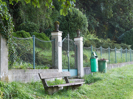
From Mondsee to the viewpoint Riesnerhof


- Suitable for families
- culinary interesting
- Flatly
Interactive elevation profile
Create PDF
Tour-Details
Starting place: 5310 Mondsee am Mondsee
Destination: 5310 Mondsee am Mondsee
duration: 1h 19m
length: 3,8 km
Altitude difference (uphill): 179m
Altitude difference (downhill): 178m
Lowest point: 495m
Highest point: 654m
difficulty: easy
condition: easy
panoramic view: Great panorama
Paths covering:
Asphalt, Hiking trail
powered by TOURDATA
A short hiking tour to Mondseeberg and the Riesnerhof-inn with a fantastic view all over the lake and the village.
From the tourist office we walk through Badgasse to the basilica, past this on the right to Hilfbergstraße. We follow this (path 1) to the pilgrimage church Maria Hilf and further up to the underpass of the motorway. After this, path no. 33 branches off to the left to the urn cemetery. We follow this. It's almost flat through the forest above the motorway.
Afterwards we choose path no. 5 to the right. It leads a little uphill through the forest. Soon we come to the Wiesenweg and see the Riesnerhof on the left in front of us. We walk along the hedge, but leave path no.5 at the corner, which leads to the farmhouse on the right. We turn left. Via the meadow path next to the hedge we reach a house driveway and come to the parking lot of the Riesnerhof inn. From here there is a great view of the MondSeeLand. For the way back we walk past the parking lot to Mondseebergstraße and follow it downhill. In the S-curve, forest path no. 3 branches off to the left, which - past the water reservoir - brings us back under the motorway to the Gosaugraben. We descend to the stream, walk along it and straight ahead - past the barrier - we come through the castle courtyard and turn left into the church and market square.
Afterwards we choose path no. 5 to the right. It leads a little uphill through the forest. Soon we come to the Wiesenweg and see the Riesnerhof on the left in front of us. We walk along the hedge, but leave path no.5 at the corner, which leads to the farmhouse on the right. We turn left. Via the meadow path next to the hedge we reach a house driveway and come to the parking lot of the Riesnerhof inn. From here there is a great view of the MondSeeLand. For the way back we walk past the parking lot to Mondseebergstraße and follow it downhill. In the S-curve, forest path no. 3 branches off to the left, which - past the water reservoir - brings us back under the motorway to the Gosaugraben. We descend to the stream, walk along it and straight ahead - past the barrier - we come through the castle courtyard and turn left into the church and market square.
Accessibility / arrival
The tour starts at the Mondsee-Irrsee tourist office in the center of Mondsee. Free parking is available at the Mondsee lake promenade.
- Parking space: 100
none
- Suitable for groups
- Suitable for seniors
- Suitable for single travelers
- Suitable for families
- Suitable for friends
- Suitable for couples
- Suitable for children
- Spring
- Summer
- Autumn
- Early winter
Please get in touch for more information.
Dr. Franz Müller Straße 3
5310 Mondsee am Mondsee
Phone +43 6232 2270
E-Mail info@mondsee.at
Web mondsee.salzkammergut.at
https://mondsee.salzkammergut.at
Interactive elevation profile
Create PDF
Tour-Details
Starting place: 5310 Mondsee am Mondsee
Destination: 5310 Mondsee am Mondsee
duration: 1h 19m
length: 3,8 km
Altitude difference (uphill): 179m
Altitude difference (downhill): 178m
Lowest point: 495m
Highest point: 654m
difficulty: easy
condition: easy
panoramic view: Great panorama
Paths covering:
Asphalt, Hiking trail
powered by TOURDATA


