Pokéwalk Linz


4020 Linz

Rediscover Linz - with Pokémon Go, the (unofficial) Pokemon Go Trainer Route through Linz! On this 10-kilometre route, you will discover Linz - the UNESCO City of Media Arts - from a very special perspective. The 10-kilometre loop is also perfect for hatching one of the rare Pokémon eggs or collecting gifts from the sights of Linz that you can send to your friends or add a postcard to your postcard book.
- Ars Electronica Centre (Arena at AEC and Salon Ship Florrentine)
- Volksgarten (arena at the Jahn Monument & Stelzhammer Monument)
- Music theatre
- Lentos Art Museum
- Linz Central Station (several arenas)
- New railway bridge
- Linz main square
- Linzer Landstraße
- Tobacco Factory (several arenas)
- Danube Park
Useful tips before you set off:
- Free WLAN: At http://hotspot.linz.at/ you will find all areas in Linz where free WLAN is offered.
- Battery pack: Due to the length of the tour, we recommend bringing your own battery pack!
Our starting point is Linz Central Station, where you already have the opportunity to train in several arenas or conquer the arena for your team and master joint raids with friends. Continue via Wissensturm along Beethovenstraße (arena near the Cembran Keller) to Stockhofstraße. Here you can top up your inventory at several Pokéstops. If you take a detour to Bauernbergpark, you might find a Machollo or Pantimos waiting for you! Take Stockhofstraße to Auerspergplatz and from there via Volksgartenstraße back to Volksgarten, where you will also find an arena and several Pokéstops. How about a short break in the Volksgarten Café, which is located directly in the Linz Music Theatre? That would be your chance to meet a Jurob!
Continue along Landstraße past Schillerpark (watch out: maybe a Bisasam is hiding in the park?) to Ursulinenhof on nearby OK-Platz, where there are further opportunities to conquer an arena. The area in front of the Nordico City Museum is also a popular meeting place for Pokémon trainers with several Pokéstops close together.
The tour continues to Linz's main square, one of the largest enclosed squares in Austria. Water-type Pokémon such as Sterndu and Goldini can often be found here and along the Danube.
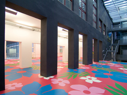
Now cross the Nibelungen Bridge towards the AEC -Ars Electronica Centre. In the Museum of the Future, you can experience visionary media art up close and personal and the Deep Space impresses with spectacular images! How about a 3D journey through the universe, for example? You can also put your Pokémon skills to the test in the arena located here.
You can then take the Pöstlingbergbahn railway, which passes close to the AEC, up the Pöstlingberg, enjoy the wonderful view and then immerse yourself in the fairytale world of the grotto railway. The dragon Sebastian and the dwarves may not end up in your Pokédex, but it's still worth a visit.
If you want to stay on the Pokéwalk, continue downstream along the Danube, past the Florentine saloon boat (also an arena) to the new railway bridge. This offers a walkway for pedestrians and takes you back across the Danube. The next arena is already waiting for you on the south side. Upstream you will reach the tobacco factory. If you are still missing Rossana in your collection - a number of them have already been spotted and successfully caught here by local players. And if you've got hungry from all that Pokémon collecting - there are a number of gastronomic offerings in and around the Tobacco Factory area.
The cultural mile continues along the Danube to the Brucknerhaus, where the Sandburg provides Caribbean flair in summer. The route then continues along Kaisergasse to the Landesgalerie. Here, turn left into Museumsstraße and follow Huemerstraße to the idyllic Stadtpark. Top up your inventory here - and maybe you'll be lucky enough to catch a Sichlor on your way!
The Neustadt district is very popular with local players and there are also plenty of Pokéstops here. Continue along Starhembergstraße or alternatively Dinghoferstraße to get back to Blumauerstraße - and you'll be on the home stretch back to the starting point, Linz Central Station. Take another good look around here - Pikachu is said to have been in this area from time to time!
Have fun exploring Linz! And to make sure you have fun: keep your eyes open and always pay attention to your surroundings! :-)
- All weather
- Suitable for groups
- Suitable for kids (all ages)
- Pets allowed
- Suitable for teenagers
- Suitable for single travelers
- Suitable for families
- Suitable for friends
- Suitable for couples
- Suitable for children
- Spring
- Summer
- Autumn
- Early winter
- Deep winter
Please get in touch for more information.
Linzer Stadtgebiet
4020 Linz
Phone +43 732 7070 - 2009
E-Mail tourist.info@linz.at
Web pokemongolive.com/de/
Web www.visitlinz.at/
https://www.visitlinz.at/
")
")
")
")
")
")
")
")
")
")
")
Vis-à-vis users
1. The tours presented for hiking, walking, biking and road biking, mountain biking, motorbiking, horseback riding, climbing, cross-country skiing, and going on skiing and snowshoe tours etc. are to be considered non-paid tour recommendations and only serve as non-binding information. We have no intention of concluding a contract with the users of this website. The utilisation of the data does not lead to the establishment of a contract with us.
The data may only be used for private use; any commercial use is prohibited. In particular, it is not permissible to offer the data on commercially run websites, file-sharing platforms etc. or to use it to develop commercial products. Downloading data does not imply that users are granted rights to the data concerned.
The tour recommendations posted were created with utmost care; nevertheless, we assume no liability for the correctness and completeness of the information.
We point out that neither the tour recommendations included on this website nor the associated data and information were posted by us, but rather by third parties (Art. 16 Austrian E-Commerce Act). We have no influence on whether the details provided (e.g. distance, level of difficulty, change in altitude, description etc.) are authentic, correct and complete. We do not review these third-party contents. For this reason, we assume no liability for the authenticity, correctness and completeness of the information.
Construction-related measures or other influences (e.g. landslides and similar occurrences) can lead to temporary or permanent changes in a route (e.g. loss of a bridge and similar occurrences). Such occurrences can lead to part of the route or the entire route becoming impassable.
The use of the data as well as undertaking (riding, walking, taking etc.) the recommended tours or using the network of paths occurs at users’ own risk and on their authority. In particular, users themselves are responsible for the choice of route, outdoor orientation, adherence to traffic rules, supplies and equipment for tours listed in Point 1 (e.g. bicycle etc.), wearing a helmet, estimating their own fitness, recognising dangers and maintaining an appropriate velocity. We exclude ourselves from any liability whatsoever for damages, in particular accidents, that occur whilst taking part in the recommended tours.
2.Some of the tours lead over roads with normal traffic conditions. Please observe that there is an increased risk which can be avoided by means of appropriate attention and proper estimation and implementation of one’s own abilities. For this reason, please travel a route that is unfamiliar to you slowly and with special care. Pay constant attention to potential dangers and always observe traffic. Do not leave the routes featured in descriptions.
The potential use of private roads, in particular forestry roads and agricultural transport roads, can be subject to legal restrictions, which must be observed and adhered to.
The normal traffic rules apply. Each user (e.g. biker, motorbiker) is responsible for adhering to these rules and maintaining his/her bike/vehicle and its equipment (lights, brakes etc.) in good working order. Each user is also responsible for ensuring that he/she rides at a velocity that is appropriate for the conditions and his/her skill level and for maintaining sufficient distance to the rider in front. We explicitly recommend adjusting velocity to correspond to the respective field of vision, wearing a helmet, using reflective clothing (or similar) and employing bicycle lights in line with regulations.
3.Each tour requires good physical fitness as well as detailed planning. We explicitly recommend only taking the tours in the case of optimal healthiness.
We recommend that you conclude an accident and liability insurance policy. Use an onboard computer that displays the respective kilometres travelled per day and is calibrated for the front wheel.
4.Special for mountain bikers – Fair-play rules:
Mountain biking is one of the most wonderful outdoor leisure-time activities. Whilst biking or on a mountain biking tour, mountains and lakes, meadows and cabins are re-discovered in new ways. A couple of rules for fair play in the forest help to avoid conflicts whilst mountain biking.
a.Pedestrians have the right of way: We are accommodating and friendly to pedestrians and hikers. Upon encountering these fellow travellers, we alert them by using the bicycle bell and slowly overtake them. We avoid paths with heavy pedestrian traffic altogether. Take nature into account: We do not leave refuse behind.
b.The braking distance should be half of the total distance visible: We ride at a controlled pace, are ready to brake and maintain a braking distance half as long as the total distance visible, especially in curves, because we always have to count on obstacles on the path. Damage to the path, stones, branches, wood piles, grazing livestock, cattle grids, barriers, tractor-type forestry machines and authorised vehicles pose dangers that we need to be ready for.
c.Don’t drink and drive!: Do not drink alcohol when mountain biking. Take care at stop-off points (dealing with bike racks, dirty shoes or clothing).
It is obligatory to provide first aid!
d.Marked routes, closed paths and blockades: Keep to the marked routes, observe the blockades and accept that these roads are primarily for agricultural and forestry use!
Blockades can often not be avoided and are in your own interest. Biking beyond the intended path and outside of opening times is punishable and turns us into illegal bikers.
e.We are guests in the forest and behave accordingly, including vis-à-vis forestry and hunting staff. Whilst mountain biking, mobile telephones and music players are forbidden! Biking requires your full attention.
f.Avoid unnecessary noise. Out of consideration to the animals living in the wild, we only bike during full daylight. As a principle, we always wear our helmet (even when riding uphill)! Don’t forget emergency supplies: We always have a repair set and bandages along.
g.Don’t overestimate your skills: We should not overdo it when it comes to biking technique and physical fitness. Take the level of difficulty posed by the route into consideration and make a precise estimate of your experience and skills as a biker (braking, bell, lights)!
h.Close gates: We approach grazing livestock at a walking pace and close every gate behind us. We should avoid causing escape and panic reactions in the animals. Nothing stands in the way of the fun and athletic challenge in the mountains and forests!
i.Traffic rules: The general traffic rules (StVO) apply for all the mountain biking routes and we adhere to them. Our bike therefore needs to be in perfect technical condition and equipped in line with the traffic rules, including brakes, a bell and lights. We inspect and service our mountain bikes regularly anyway.
5.We assume no liability for the contents of external websites; in particular, we assume no liability for their statements and contents. Moreover, we have no influence on the design or contents of the websites to which hyperlinks on guide.oberoesterreich.at lead or from which hyperlinks lead to guide.oberoesterreich.at. There is no on-going review of websites to which hyperlinks on guide.oberoesterreich.at lead or from which hyperlinks lead to guide.oberoesterreich.at. We do not appropriate the contents of websites to which hyperlinks on guide.oberoesterreich.at lead or from which hyperlinks lead to guide.oberoesterreich.at.
Vis-à-vis bloggers
PLEASE OBSERVE:
1. Each of your tour recommendations for hiking, walking, biking and road biking, mountain biking, motorbiking, horseback riding, climbing, cross-country skiing, and going on skiing and snowshoe tours etc., along with other details and information, is free of charge. In particular regarding the correctness of the information, we assume no liability, nor do we assume any liability whatsoever for the consequences of the use of your tour recommendation by a third party (in particular by a user of this website). We do not review the tour recommendations you post, including other details and information, at any time.
We have no intention of concluding a contract with persons who post tour recommendations and/or other details and information on this website. Posting data (information) does not imply that a contract has been concluded.
By recommending a tour, we assume special responsibility vis-à-vis other athletes. Please take this responsibility seriously and describe your tour recommendation with utmost care and to the best of your knowledge and belief.
2.Your tour recommendations must therefore clearly and unambiguously include at least the following criteria and provide a sufficiently detailed description:
• Starting point
• Detailed route description
• Distance/Overall distance
• Level of difficulty
• Dangerous spots
• Average duration of trip
• Change in altitude
• Finishing point.
If possible, please provide the change in altitude.
3.When you post a tour recommendation, you give us the order to save your tour recommendation and/or the details you provide on our website and to make it/them accessible to third parties, in particular to users of this website, in the long term. We reserve the right to block or delete tour recommendations and/or other details and/or information that you post, either partially or entirely, at any time without providing a justification. Should this occur, it grants you no rights whatsoever.
Thank you for your efforts!
4. We are not responsible for the contents of external websites; in particular, we do not assume any liability for their statements or contents. Furthermore, we do not influence the design or contents of websites that can be accessed from guide.oberoesterreich.at via hyperlinks or that use hyperlinks to refer to guide.oberoesterreich.at. The websites that can be accessed from guide.oberoesterreich.at via hyperlinks or that use hyperlinks to refer to guide.oberoesterreich.at are not regularly monitored. Furthermore, we do not assume any claims to the websites that can be accessed from guide.oberoesterreich.at via hyperlinks or that use hyperlinks to refer to guide.oberoesterreich.at.