Mountainbike-Tour Hochplett moderate


- Flatly
Interactive elevation profile
Create PDF
Tour-Details
Path number: S324
Starting place: 5310 Innerschwand am Mondsee
Destination: 5310 Innerschwand am Mondsee
duration: 3h 30m
length: 30,0 km
Altitude difference (uphill): 531m
Altitude difference (downhill): 531m
Lowest point: 484m
Highest point: 983m
difficulty: medium
condition: medium
panoramic view: Some Views
Paths covering:
Asphalt, Gravel
powered by TOURDATA
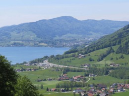
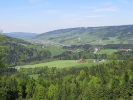
This mountain bike tour is a medium-difficult route around the Hochplett at Mondsee in the Salzkammergut.
From there we follow the asphalt road to the village of Bergen. After the wild gate begins the forest road, which we follow along its course.
After the first fantastic view of Schafberg and Zwölferhorn we turn left on the signs "Hochplett 12km". At the wood railway station we drive straight ahead along the forest road. Attention, after a few kilometres a sharp 180° curve awaits us, in which we turn left. Along the forest road it goes straight on to the starting point.
This medium-difficult tour is signposted "Hochplett 12km" - the 12km correspond to the distance of the forest roads, the access to the actual tour is not included here.
We would like to thank all the bikers for following the rules signposted at the beginning of the course and for helping to keep it open. Thank you!
Parking
- Parking space: 100
none
E-service station / recharging station- Charging point for e-bikes (free of charge)
- Suitable for seniors
- Suitable for single travelers
- Suitable for friends
- Suitable for couples
- Summer
- Autumn
Please get in touch for more information.
Dr. Franz Müller Straße 3
5310 Innerschwand am Mondsee
Phone +43 6232 2270
E-Mail info@mondsee.at
Web mondsee.salzkammergut.at
Web attersee-attergau.salzkammergut.at
https://mondsee.salzkammergut.at
https://attersee-attergau.salzkammergut.at
https://attersee-attergau.salzkammergut.at
You can also visit us on
Visit us on FacebookInteractive elevation profile
Create PDF
Tour-Details
Path number: S324
Starting place: 5310 Innerschwand am Mondsee
Destination: 5310 Innerschwand am Mondsee
duration: 3h 30m
length: 30,0 km
Altitude difference (uphill): 531m
Altitude difference (downhill): 531m
Lowest point: 484m
Highest point: 983m
difficulty: medium
condition: medium
panoramic view: Some Views
Paths covering:
Asphalt, Gravel
powered by TOURDATA


