Donausteig Stage 2_G02 Eferding - Wilhering: „Donau-water ways and living space"


- culturally interesting
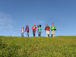
- Multi-day tour
Interactive elevation profile
Create PDF
Tour-Details
Paths covering:
The Donausteig-simply fabulous! This stage will take us from Eferding in the centre of the fertile Eferding basin on the Danube, along the mighty Danube and through its plains to Wilhering an der Donau. We discover one of the oldest cities of in Austria, the Danube as a waterway, the importance of the marine, the giant fish of the Danube River, the ancient settlement of Wilhering...
Recommended season:
- March
- April
- May
- June
- July
- August
- September
- October
- Multi-stage route
- Refreshment stops available
- Cultural/historical value
- Botanical highlights
Seal of approval:
- Quality route according to "Österreichisches Wandergütesiegel"
This Donausteig-stage starts in Eferding. The historic city in the Centre of the Eferding basin lies several kilometres south of today's route of the Danube. Eferding is the third oldest city in Austria and impresses with its beautiful city centre. The magnificent city square with Castle Starhemberg in its extension depicts its wealth and historic importance. From the Donausteig-starting point at the edge of the town we hike on secondary roads in a long right curve through rural cultural landscape: agriculture field, large farms, wayside crosses,... In the rural settlement of Unterschaden, we turn to the North into the Auwald (forest). On an asphalted Austraße we reach the Aschach (river), and follow it about 1 km downstream in a curve to the right. Then, we cross the Aschach and stand in front of the Danube next to the Donausteig-resting point "Langer Haufen". Powerfully flows the Danube past us here. The next 5 kilometres, we walk on the tarmac Danube river dam downstream. The uniform route offers lots of space to ponder and philosophize. Suddenly the unknown world of the "Danube" waterway pushes into our consciousness and we discover the Danube as a playground for all kinds of adventurers: cyclists, canoeists,... we are not alone! Within sight of the Danube power plant Ottensheim Wilhering, we leave the Danube and follow the Innbach (stream) to the right for the next 3 km on a road through forests. During this stage, we circle the plant Ottensheim Wilhering in a left long arc. The bridge of the power plant entrance in Fall allows us to cross the Innbach and we walk on its other side further downstream. After the Donausteig-resting area "Fischlehrpfad" does the Donausteig turn again into the Auwald (forest), until we reach again the Danube in the settlement of Wilhering/Ufer. A short time later, we are at the Donausteig-starting point "Wilhering" at the ferry terminal of the Rollfähre Ottensheim Wilhering (ferry). A Donausteig-stage with plenty of room for the pondering.
Discover the following features with the Donausteig-diary
-Eferding-at the heart of the empire
-Donausteig-starting point 'Eferding'
-Shrines - narrative characters of the countryside
-Donausteig-resting point "langer Haufen"
-Waterway "Danube"
-The Danube and its "secret" characters
-Danube power plant Ottensheim Wilhering
-Balance-life at water level
- ...
Download: Donausteig-diary "Stage 2_G02 Eferding Wilhering" - yet to follow!
ATTENTION: Those who wants to go to Ottensheim at the end of this stage, use the Rollfähre (ferry) "Ottensheim Wilhering"
Directions:From the Donausteig-starting point "Eferding" we cross the parking lot of the Eferding public baths and follow the road North. After about 800 m, we turn right in Wörth. A small farm road now brings us towards East. At the intersection in the rural settlement of Unterschaden (large farm to the right) we proceed straight a few meters, then turn left into the Auwald (Forest). Now a tarmac road continue in a curve to the right past a wastewater treatment plant and then along the Aschach downstream to a bridge. Cross the bridge and turn left. A few feet further on we are in front of the Danube and the Donausteig-resting point "Lang Haufen". From here, a few kilometres downstream the Donausteig follows the asphalted Danube River Dam. Within sight of the Danube power plant Ottensheim Wilhering, we leave the Danube and walk right onto a narrow road leading backing into the Auwald along the Innbachs (stream). We encircle the power plant in a long left band. At the bridge in Fall (power plant access road), we cross the Innbachs (stream) and turn right and then again left. Briefly through a settlement, we continue along again on the bank of the Innbachs (stream). After the Donausteig-resting point "Fischlehrpfad" the Danube route branches off from the Innbachs (stream) and through lowland forests, until we reach the bank of the Danube at Wilhering/Ufer. A short time later, we are at the Donausteig-starting point "Wilhering"and at the ferry terminal of the Rollfähre (ferry) Ottensheim-Wilhering.
To facilitate the orientation, the Donausteig was provided with its own system of orientation - you will find the description here .
ATTENTION: Those who wants to go to Ottensheim at the end of this stage, use the Rollfähre (ferry) "Ottensheim Wilhering"
Tip:A walk through the city center of Eferding opens up interesting sites of the history of Austria's third oldest city!Equipment:
No special requirements apart from basic hiking gear.Additional information:
WGD Tourismus GmbH
Lindengasse 9
4040 Linz, Austria
Tel. +43(0)732/7277-800
Fax. +43(0)732/7277-804
info@donausteig.com
Tourism center Eferding
Tel.: +43(0)7272/5555-160 Fax DW -161
tourismusverband@eferding.ooe.gv.at
www.eferding.at
Market municipal office Wilhering
4073 Wilhering
Linzer Str. 14
Tel.: +43(0)7226(2255
Fax: +43(0)7226/3095
gemeinde@wilhering.ooe.gv.at
www.wilhering.at
further information:
- Multi-day tour
- Board possible


")

Direction information: Departure

")

")

")
")

")
Getting there
The Eferdinger Public baths lies aprox. 250 m south east from the Eferdinger starting point. Depending on the arrival direction there are different ways to reach the Eferdinger starting point. (Navigation: A‑4070 Eferding, Freibad/Ludlgasse).
Public Transit
Eferding can be reached by train and bus. A transfer back from Wilhering is possible by bus. One should take notice that the train station of Eferding is a bit further away from the starting point! Information on bus timetables online at http://www.ooevv.at .
Parking
Free parking space without time limit at the Eferding swimming pool
- Spring
- Summer
- Autumn
Please get in touch for more information.
Lindengasse 9
4040 Linz
Phone +43 732 7277 - 800
Fax machine +43 732 7277 - 804
E-Mail info@donauregion.at
Web www.donauregion.at
Web www.wilhering.at/
https://www.wilhering.at/
Vis-à-vis users
1. The tours presented for hiking, walking, biking and road biking, mountain biking, motorbiking, horseback riding, climbing, cross-country skiing, and going on skiing and snowshoe tours etc. are to be considered non-paid tour recommendations and only serve as non-binding information. We have no intention of concluding a contract with the users of this website. The utilisation of the data does not lead to the establishment of a contract with us.
The data may only be used for private use; any commercial use is prohibited. In particular, it is not permissible to offer the data on commercially run websites, file-sharing platforms etc. or to use it to develop commercial products. Downloading data does not imply that users are granted rights to the data concerned.
The tour recommendations posted were created with utmost care; nevertheless, we assume no liability for the correctness and completeness of the information.
We point out that neither the tour recommendations included on this website nor the associated data and information were posted by us, but rather by third parties (Art. 16 Austrian E-Commerce Act). We have no influence on whether the details provided (e.g. distance, level of difficulty, change in altitude, description etc.) are authentic, correct and complete. We do not review these third-party contents. For this reason, we assume no liability for the authenticity, correctness and completeness of the information.
Construction-related measures or other influences (e.g. landslides and similar occurrences) can lead to temporary or permanent changes in a route (e.g. loss of a bridge and similar occurrences). Such occurrences can lead to part of the route or the entire route becoming impassable.
The use of the data as well as undertaking (riding, walking, taking etc.) the recommended tours or using the network of paths occurs at users’ own risk and on their authority. In particular, users themselves are responsible for the choice of route, outdoor orientation, adherence to traffic rules, supplies and equipment for tours listed in Point 1 (e.g. bicycle etc.), wearing a helmet, estimating their own fitness, recognising dangers and maintaining an appropriate velocity. We exclude ourselves from any liability whatsoever for damages, in particular accidents, that occur whilst taking part in the recommended tours.
2.Some of the tours lead over roads with normal traffic conditions. Please observe that there is an increased risk which can be avoided by means of appropriate attention and proper estimation and implementation of one’s own abilities. For this reason, please travel a route that is unfamiliar to you slowly and with special care. Pay constant attention to potential dangers and always observe traffic. Do not leave the routes featured in descriptions.
The potential use of private roads, in particular forestry roads and agricultural transport roads, can be subject to legal restrictions, which must be observed and adhered to.
The normal traffic rules apply. Each user (e.g. biker, motorbiker) is responsible for adhering to these rules and maintaining his/her bike/vehicle and its equipment (lights, brakes etc.) in good working order. Each user is also responsible for ensuring that he/she rides at a velocity that is appropriate for the conditions and his/her skill level and for maintaining sufficient distance to the rider in front. We explicitly recommend adjusting velocity to correspond to the respective field of vision, wearing a helmet, using reflective clothing (or similar) and employing bicycle lights in line with regulations.
3.Each tour requires good physical fitness as well as detailed planning. We explicitly recommend only taking the tours in the case of optimal healthiness.
We recommend that you conclude an accident and liability insurance policy. Use an onboard computer that displays the respective kilometres travelled per day and is calibrated for the front wheel.
4.Special for mountain bikers – Fair-play rules:
Mountain biking is one of the most wonderful outdoor leisure-time activities. Whilst biking or on a mountain biking tour, mountains and lakes, meadows and cabins are re-discovered in new ways. A couple of rules for fair play in the forest help to avoid conflicts whilst mountain biking.
a.Pedestrians have the right of way: We are accommodating and friendly to pedestrians and hikers. Upon encountering these fellow travellers, we alert them by using the bicycle bell and slowly overtake them. We avoid paths with heavy pedestrian traffic altogether. Take nature into account: We do not leave refuse behind.
b.The braking distance should be half of the total distance visible: We ride at a controlled pace, are ready to brake and maintain a braking distance half as long as the total distance visible, especially in curves, because we always have to count on obstacles on the path. Damage to the path, stones, branches, wood piles, grazing livestock, cattle grids, barriers, tractor-type forestry machines and authorised vehicles pose dangers that we need to be ready for.
c.Don’t drink and drive!: Do not drink alcohol when mountain biking. Take care at stop-off points (dealing with bike racks, dirty shoes or clothing).
It is obligatory to provide first aid!
d.Marked routes, closed paths and blockades: Keep to the marked routes, observe the blockades and accept that these roads are primarily for agricultural and forestry use!
Blockades can often not be avoided and are in your own interest. Biking beyond the intended path and outside of opening times is punishable and turns us into illegal bikers.
e.We are guests in the forest and behave accordingly, including vis-à-vis forestry and hunting staff. Whilst mountain biking, mobile telephones and music players are forbidden! Biking requires your full attention.
f.Avoid unnecessary noise. Out of consideration to the animals living in the wild, we only bike during full daylight. As a principle, we always wear our helmet (even when riding uphill)! Don’t forget emergency supplies: We always have a repair set and bandages along.
g.Don’t overestimate your skills: We should not overdo it when it comes to biking technique and physical fitness. Take the level of difficulty posed by the route into consideration and make a precise estimate of your experience and skills as a biker (braking, bell, lights)!
h.Close gates: We approach grazing livestock at a walking pace and close every gate behind us. We should avoid causing escape and panic reactions in the animals. Nothing stands in the way of the fun and athletic challenge in the mountains and forests!
i.Traffic rules: The general traffic rules (StVO) apply for all the mountain biking routes and we adhere to them. Our bike therefore needs to be in perfect technical condition and equipped in line with the traffic rules, including brakes, a bell and lights. We inspect and service our mountain bikes regularly anyway.
5.We assume no liability for the contents of external websites; in particular, we assume no liability for their statements and contents. Moreover, we have no influence on the design or contents of the websites to which hyperlinks on guide.oberoesterreich.at lead or from which hyperlinks lead to guide.oberoesterreich.at. There is no on-going review of websites to which hyperlinks on guide.oberoesterreich.at lead or from which hyperlinks lead to guide.oberoesterreich.at. We do not appropriate the contents of websites to which hyperlinks on guide.oberoesterreich.at lead or from which hyperlinks lead to guide.oberoesterreich.at.
Vis-à-vis bloggers
PLEASE OBSERVE:
1. Each of your tour recommendations for hiking, walking, biking and road biking, mountain biking, motorbiking, horseback riding, climbing, cross-country skiing, and going on skiing and snowshoe tours etc., along with other details and information, is free of charge. In particular regarding the correctness of the information, we assume no liability, nor do we assume any liability whatsoever for the consequences of the use of your tour recommendation by a third party (in particular by a user of this website). We do not review the tour recommendations you post, including other details and information, at any time.
We have no intention of concluding a contract with persons who post tour recommendations and/or other details and information on this website. Posting data (information) does not imply that a contract has been concluded.
By recommending a tour, we assume special responsibility vis-à-vis other athletes. Please take this responsibility seriously and describe your tour recommendation with utmost care and to the best of your knowledge and belief.
2.Your tour recommendations must therefore clearly and unambiguously include at least the following criteria and provide a sufficiently detailed description:
• Starting point
• Detailed route description
• Distance/Overall distance
• Level of difficulty
• Dangerous spots
• Average duration of trip
• Change in altitude
• Finishing point.
If possible, please provide the change in altitude.
3.When you post a tour recommendation, you give us the order to save your tour recommendation and/or the details you provide on our website and to make it/them accessible to third parties, in particular to users of this website, in the long term. We reserve the right to block or delete tour recommendations and/or other details and/or information that you post, either partially or entirely, at any time without providing a justification. Should this occur, it grants you no rights whatsoever.
Thank you for your efforts!
4. We are not responsible for the contents of external websites; in particular, we do not assume any liability for their statements or contents. Furthermore, we do not influence the design or contents of websites that can be accessed from guide.oberoesterreich.at via hyperlinks or that use hyperlinks to refer to guide.oberoesterreich.at. The websites that can be accessed from guide.oberoesterreich.at via hyperlinks or that use hyperlinks to refer to guide.oberoesterreich.at are not regularly monitored. Furthermore, we do not assume any claims to the websites that can be accessed from guide.oberoesterreich.at via hyperlinks or that use hyperlinks to refer to guide.oberoesterreich.at.
Interactive elevation profile
Create PDF
Tour-Details
Paths covering: