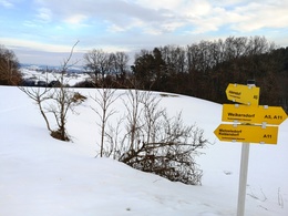
A11 circular route Weikersdorf - Matzelsdorf - Kelzendorf


- Flatly
Interactive elevation profile
Create PDF
Tour-Details
Starting place: 4211 Alberndorf in der Riedmark
Destination: 4211 Alberndorf in der Riedmark
duration: 1h 3m
length: 3,6 km
Altitude difference (uphill): 88m
Altitude difference (downhill): 91m
Lowest point: 606m
Highest point: 700m
difficulty: very easy
condition: very easy
panoramic view: Some Views
Paths covering:
Street, Hiking trail
powered by TOURDATA
Circular route from Weikersdorf via Matzelsdorf and Kelzendorf
Starting point: Weikersdorf
Destination: Weikersdorf
further information:
- Flatly
- Board possible
Most economical season
- Spring
- Summer
- Autumn
- Early winter
Please get in touch for more information.
4211 Alberndorf in der Riedmark
Phone +43 7235 7155
E-Mail tourismusverband@alberndorf.ooe.gv.at
Web www.alberndorf.at/
https://www.alberndorf.at/
")
")
")
Interactive elevation profile
Create PDF
Tour-Details
Starting place: 4211 Alberndorf in der Riedmark
Destination: 4211 Alberndorf in der Riedmark
duration: 1h 3m
length: 3,6 km
Altitude difference (uphill): 88m
Altitude difference (downhill): 91m
Lowest point: 606m
Highest point: 700m
difficulty: very easy
condition: very easy
panoramic view: Some Views
Paths covering:
Street, Hiking trail
powered by TOURDATA